AI & Data
Sumatra Rice Production Forecasting WebGIS
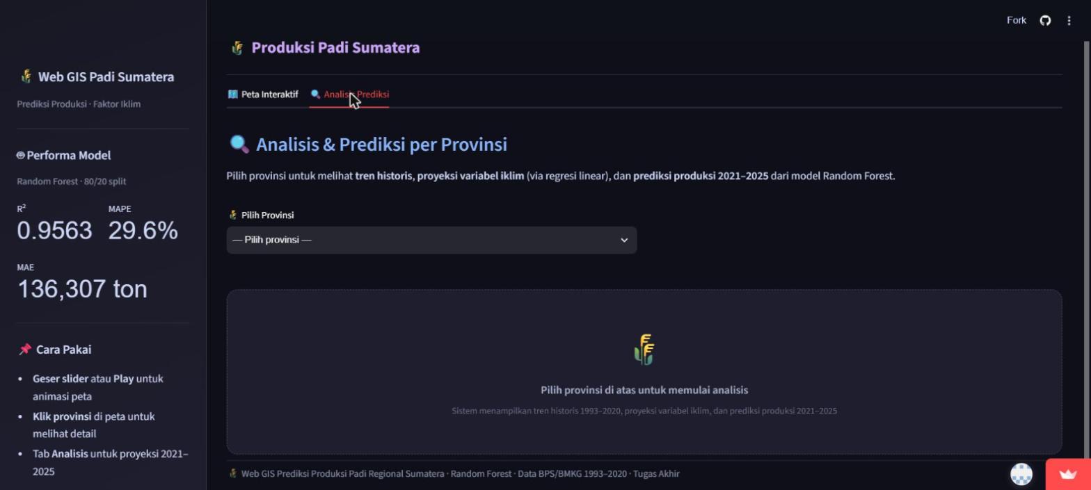
A geospatial web application predicting rice production across Sumatra's 8 provinces. It combines a historical choropleth map (1993-2020) with a climate-scenario projection mode (2021-2025) driven by a Random Forest regression model, letting a user adjust temperature, rainfall, humidity, and harvest-area inputs and see the resulting production forecast update live on the map.
- Machine Learning & Geospatial Developer
- 2026
- Python, Streamlit, Folium, scikit-learn, Pandas
Studi Kasus
01 / MASALAH
Agricultural planning benefits from seeing how climate variables translate into production outcomes across a region, not just as a table of numbers but as a map a non-technical viewer can read directly.
02 / PROSES
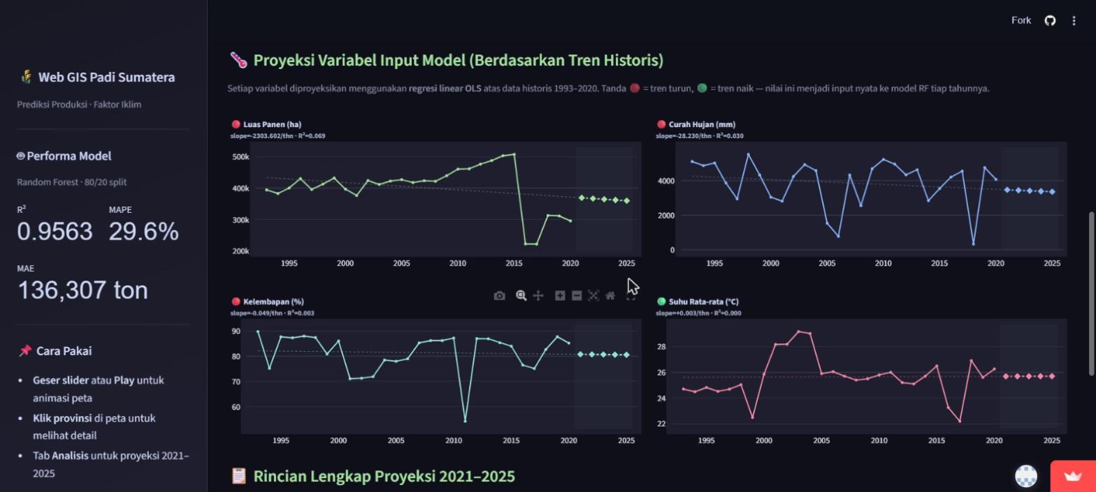
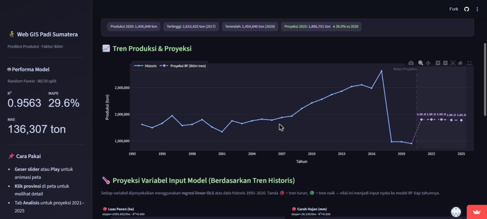
Built with Streamlit and a Folium choropleth over an 8-province Sumatra GeoJSON boundary set, using historical BPS/BMKG data (1993-2020: harvested area, rainfall, humidity, average temperature) to train a Random Forest regression model on an 80/20 split. Each climate variable is also projected forward via its own linear regression trend, and those projected values feed the same Random Forest model to produce a province-level production forecast for 2021-2025, adjustable live via sliders.
03 / HASIL
A deployed, publicly usable web application (Streamlit Community Cloud) with two working modes: a historical time-slider map and a climate-scenario forecasting map, reporting the model's own measured accuracy directly in its interface (R² ≈ 0.956, MAPE ≈ 29.6%, MAE ≈ 136,307 tons, as displayed live in the deployed app at the time of this review).
Galeri Proyek
Tertarik untuk bekerja sama?
Hubungi saya untuk membahas sebuah proyek, atau lihat dulu karya lainnya.